Bjelasnica Approaches
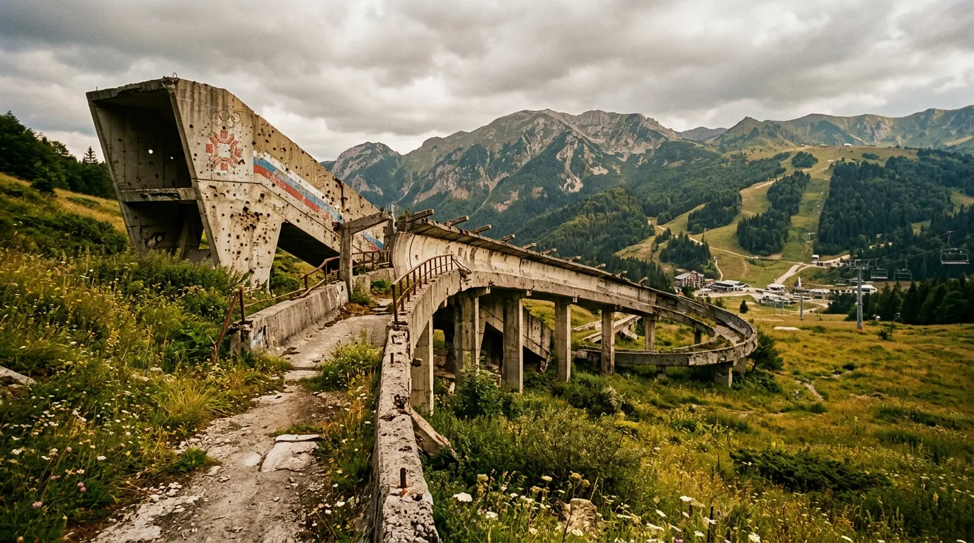
The Olympic rings are still there. Not proudly displayed, not maintained, not lit up at night for tourists — just fading into the concrete of a timing hut at the top of a ski run that was, for two weeks in February 1984, the center of the alpine skiing world. The paint is peeling. The roof has a hole. A bullet impact has removed part of the right-hand ring. This is Bjelasnica, and the bullet hole is not decorative.
Bjelasnica mountain stands directly south of Sarajevo at 2,067 meters, and its approach roads climb from the outskirts of the Bosnian capital to the summit plateau through a landscape that reads like a compressed history of late twentieth-century Europe. Olympic infrastructure from 1984. Shelling damage from the siege of Sarajevo (1992-1996). Reconstruction from the 2000s. New development from the 2010s. And threading through all of it, mountain roads that climb from 500 meters to 1,500 meters in twenty-five kilometers, offering driving that is uncomplicated but emotionally complex in a way that no Swiss pass can match.
Why drive the Bjelasnica approaches
The Bjelasnica is not a pass in the traditional sense. There is no single road that crosses from one side of the mountain to the other through a summit gap. Instead, several approach roads radiate upward from Sarajevo’s southern suburbs, reaching the ski resort area and the highland plateau at different points. The driving interest comes from the variety of routes, the dramatic setting above the Sarajevo basin, and the historical layers that the roads pass through.
The main approach — the road from Ilidza through Hadzici to the ski resort — is a well-maintained two-lane highway that climbs steadily through forest. It is the route the Olympic athletes took in 1984, and it remains the primary access. The secondary approaches are more interesting for driving: narrower roads through villages and forest that feel less polished and more authentic.
What makes Bjelasnica unique on SteepPass is the context. You are driving uphill from a city that endured the longest siege in modern European history. The transition from urban to mountain happens quickly — twenty minutes from the center of Sarajevo, you are on a forested mountain road with views across a basin that was, within living memory, a war zone. The bobsled track from the 1984 Olympics, visible on the ridge of neighboring Trebevic mountain, is covered in graffiti and partially destroyed. The ski jumps on Igman are overgrown. The approach roads to Bjelasnica pass through communities that were on the front lines.
This is not ruin tourism. Sarajevo is a vibrant, recovering city, and Bjelasnica is an active ski resort with new lifts and lodges. But the history is not hidden, and driving these roads with awareness of what happened here adds a dimension that altitude statistics cannot capture.
The approaches
Main approach: Ilidza to Bjelasnica ski resort
The primary route follows the main road south from Ilidza (a suburb of Sarajevo, accessible from the Ring Road) through Hadzici and upward to the ski resort at approximately 1,200 meters. This road was upgraded for the 1984 Olympics and maintained since, with recent improvements funded by tourism investment.
| Segment | Km | Elevation | Character |
|---|---|---|---|
| Ilidza to Hadzici | 0-12 | 500-700m | Suburban, two-lane, moderate traffic |
| Hadzici to forest zone | 12-18 | 700-1,000m | Forest road, hairpins begin, quality good |
| Forest zone to ski resort | 18-25 | 1,000-1,200m | Mountain road, scenic, moderate gradient |
The driving is straightforward — good asphalt, reasonable width, guardrails on the exposed sections. The hairpins are wide and well-engineered. This is a weekend-driver road, suitable for any vehicle.
The interest is in the destination: the ski resort plateau, with its mix of new construction and Olympic-era buildings in various states of repair. From the resort area, gravel tracks lead higher to the Bjelasnica summit ridge, where the views extend across the Bosnian highlands toward the Herzegovinian coast. These upper tracks are not paved and require care, but they are accessible to standard cars in dry weather.
Eastern approach: Trebevic saddle route
The more dramatic approach climbs from the eastern suburbs of Sarajevo over the Trebevic saddle. This route passes directly through terrain that was heavily contested during the siege — the hillsides are marked with mine-clearance signs (stay on paved roads; cleared areas are marked, uncleared areas are not), and several ruins along the road are war-damaged rather than merely derelict.
The road itself is narrower than the main approach, with single-lane sections through forest and a summit saddle at roughly 1,200 meters. The views back toward Sarajevo from the Trebevic ridge are extraordinary — the city fills the basin below, surrounded by hills that are now peaceful but whose strategic significance is immediately obvious.
From the Trebevic saddle, secondary roads connect westward toward the Bjelasnica approach. This connecting route is the most adventurous of the approaches: narrow, occasionally rough, and passing through small highland villages that feel more remote than their proximity to Sarajevo would suggest.
Western approach: Igman road
The western approach via Igman mountain follows the road that served as Sarajevo’s lifeline during the siege. The Igman road (and the tunnel beneath the airport runway) was the only route in and out of the besieged city for much of the 1992-1996 period. The tunnel is now a museum. The road is now a regular highway. But driving it with the knowledge of what it meant — the food, the fuel, the ammunition that moved along this road under fire — is an experience that highway engineering alone cannot provide.
From Igman, the road connects to the main Bjelasnica approach at Hadzici. The Igman section itself passes the Olympic ski jumping hills, now partially overgrown, and offers views across the Sarajevo basin from the west.
Kilometer by kilometer: main approach
Km 0-8: Ilidza outskirts
The drive begins at the Ilidza junction on Sarajevo’s ring road. The first eight kilometers are suburban — busy, unremarkable, necessary. The road passes through Hadzici, where fuel and supplies are available. Stock up here; there is nothing on the mountain except the ski resort facilities.
Km 8-15: Into the forest
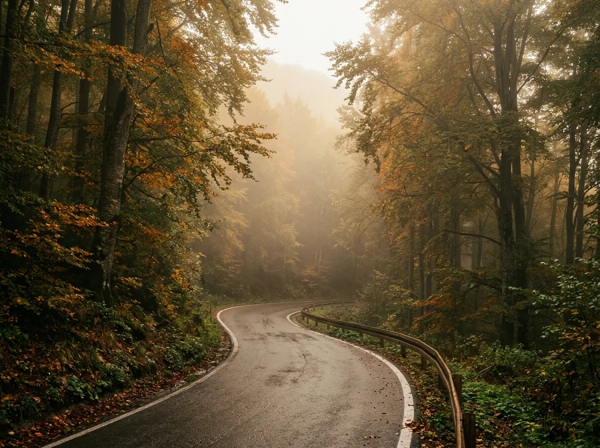
Above Hadzici, the road leaves the urban fringe and enters dense mixed forest. The gradient steepens, and the first hairpins appear. These are wide, well-surfaced, and shaded by the tree canopy. The transition from city to forest happens quickly — within three kilometers, the apartment blocks are replaced by beech and pine, and the sound of traffic fades to birdsong.
The forest on Bjelasnica is dense and atmospheric. The trees are tall, the undergrowth thick, and in morning fog, the road has a visibility that extends about two car lengths. The fog is common in spring and autumn and adds a Gothic quality to what is otherwise a gentle mountain drive.
Km 15-22: Mountain road
Above 1,000 meters, the forest opens periodically to reveal views across the Sarajevo basin. The hairpins continue, wider-spaced now, and the gradient eases slightly. The road surface is good but not immaculate — frost damage creates some unevenness, and the occasional pothole appears without warning.
This section passes several small highland settlements — clusters of houses with vegetable gardens and woodpiles that look like they belong in a different century. Some of these settlements were abandoned during the war and have been only partially reoccupied. The mixture of maintained and abandoned buildings gives the landscape a patchwork quality.
Km 22-25: Ski resort plateau
The road arrives at the Bjelasnica ski resort plateau at approximately 1,200 meters. The resort is a functioning facility with lifts, lodges, restaurants, and accommodation. In summer, it serves as a base for hiking and mountain biking. The architecture is a mixture of brutalist Olympic-era buildings and new wooden chalets, and the combination is more appealing than it sounds.
From the resort, a road continues upward toward the summit area. This upper section is partially paved, partially gravel, and leads to viewpoints at 1,400-1,500 meters with panoramic views of the Bosnian highlands. On clear days, the view south extends to Prenj and the mountains of Herzegovina.
Practical information
| Detail | Information |
|---|---|
| Opening dates | Year-round on main approach. Upper tracks may be snow-blocked Nov-Apr. |
| Toll | None |
| Fuel | Hadzici (on approach) and Ilidza (near start). Nothing on mountain. |
| Parking | Ski resort has ample parking (free in summer). Pull-offs at viewpoints. |
| Best time of day | Morning for clearest views. Afternoon fog common spring/autumn. |
| Avoid | Winter weekends (ski traffic). Post-rain conditions on upper gravel tracks. |
| Length | 25km from Ilidza to ski resort on main approach |
| Drive time | 40-60 minutes from Sarajevo center to ski resort |
| Mine warning | Stay on paved roads and marked trails. Mine clearance is ongoing. Marked areas are safe; unmarked areas are not guaranteed. |
A note on mines
Bosnia retains areas of uncleared mines from the 1992-1995 conflict. On the Bjelasnica approaches, the paved roads are safe. Established hiking trails are safe. Cleared areas are marked with signs. The risk is exclusively off-trail and off-road — walking or driving into unmarked terrain. Stay on paved surfaces and marked paths, and the risk is zero. This is not a theoretical caution; it is a practical instruction that Bosnians themselves follow.
Combine with nearby routes
Bjelasnica + Prenj + Mostar: The Bosnia Mountain Traverse links the Bjelasnica approaches with the mountain route south to Mostar, bypassing the main highway through a landscape of highlands and canyons. Two days, 200km, and a very different way to experience the Sarajevo-Mostar corridor.
Bjelasnica + Lukomir village: From the ski resort, a gravel road leads to Lukomir, the highest permanently inhabited village in Bosnia (1,495m). The road is rough and requires a vehicle with reasonable ground clearance, but Lukomir itself — stone houses, traditional pastoral farming, views across the Rakitnica canyon — is a destination that justifies the road quality.
Bjelasnica + Trebevic: Combine the mountain drive with a visit to the abandoned Olympic bobsled track on Trebevic. The track is accessible by car and foot, and walking along the overgrown concrete chute with its faded Olympic markings and war-era graffiti is one of the most evocative experiences in Sarajevo.
Driving up Bjelasnica from Sarajevo takes about forty minutes and spans roughly thirty years of European history. The approach roads pass through neighborhoods rebuilt after the siege, communities that remember the war, and a landscape that is both scarred and recovering. At the top, Olympic ruins and new ski lodges share the same plateau. It is not the most technically demanding drive on this site. It is not the highest, the steepest, or the most remote. But it may be the one that stays with you longest, because the mountain roads of Bjelasnica do not just climb to a view — they climb through a history that you can see, touch, and feel through the steering wheel.